MOUNT TAMALPAIS, Calif. – The folks at AT&T kindly sent Fortune’s San Francisco bureau an iPhone 3G on Friday to try out. Now, Green Wombat is a Mac kind of marsupial but no Apple (AAPL) fan boy. So over the weekend I was most interested in how the new phone performed in the Bay Area’s topographically diverse terrain, where mountains, valleys and exceedingly tall redwoods can play havoc with cell signals.
 More to the point, how fast and useful is the GPS-enabled Jesus phone on the mountain bike trails that surround San Francisco? After all, this is a place where you can be sitting on the 19th floor one minute and a half hour later be bombing down a fire road on a stretch of state park that seems as remote as the Sierra. But we still want to be connected; witness the techies texting on the trails or the matchy-match Mill Valley cyclists pedaling their $6,000 rigs, BlackBerrys aloft, to the next peak in search of a signal.
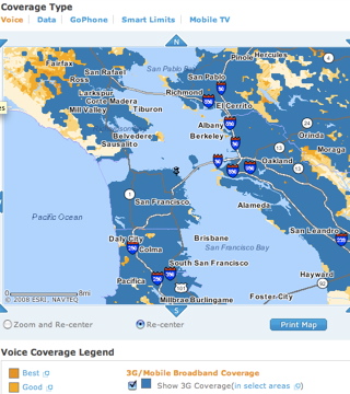
So what better place to put the iPhone 3G through its paces than Mount Tamalpais in Marin County, mountain biking’s birthplace? AT&T (T) claims 3G blankets most of the Bay Area, but that can depend on your altitude. As I throw the bike on the car rack at my home near the top of the Berkeley Hills, it’s clear I live on the EDGE – the iPhone is only picking up AT&T’s slower network. Rolling down the hill, the 3G kicks in. (This will happen occasionally elsewhere, such as in Fairfax, a Marin town sitting in the shadow of Mount Tam, or in my office tower in downtown San Francisco.)
On Mount Tam, I pick a trail I haven’t ridden before – one with a hard-to-find entrance – to test out the iPhone’s GPS. Although the mountain is an EDGE zone, the GPS-Google satellite maps mashup pinpoints my location with a luminecent blue dot, allowing me to zoom in and see that I’ve just passed the trailhead and that if I backtrack I’ll even find a small gravel parking lot hidden by a stand of trees. Sweet.
 After riding a few miles through groves of bay laurel and redwood, I check my coordinates. Zooming out shows me just how long of a steep climb I’ve got ahead of me – maybe too much information. Still, this is pretty bloody cool and I snap a photo of myself that the iPhone geotags. I’m a happy rider. I compare the iPhone’s signal with my BlackBerry and they’re pulling the same number of bars, though I’ve noticed the iPhone can be much slower to grab a signal when rolling out of a dead zone.
At the crest of the hill there’s a turnoff to another trail I haven’t ridden. It’s hot and my legs are getting tired, but it looks like a fun run. Problem is, just how long and steep will this side trip be? Without the iPhone I might have given it a pass. But I move into a clearing, catch a signal and GPS myself and then take a virtual ride on the trail to see where it goes and check out the terrain. (It’s also a great way to cut down on the environmental impact of driving in the city by optimizing routes.) Looks good. It turns out to be a great spur, taking me to the Bolinas-Fairfax Ridge overlooking the Pacific Ocean. While enjoying the view, I contemplate writing this blog post on the phone (WordPress has been iPhone-optimized for that) but ditch the idea, given iPhone’s lack of a cut-and-paste function and inability to import photos to the post.
There’s another problem: I’m about to enter the red zone on the battery meter. The phone has been on for just some four hours and the battery is already 80 percent depleted, though I haven’t been surfing the web much – mainly using the GPS and maps and listening to music on the drive to Mount Tam. (Unfortunately, while the iPhone will play music over the older iPod cable in my car and on my Soundock at home, it won’t charge while plugged in. I end up charging the phone twice a day over the weekend.)
While the prospect of not having enough juice to listen to tunes on the way home is no fun, the iPhone is a great biking companion. (An iPhone app I want to see: one that collects distance and altitude data from the bike’s wireless computer.) In fact, why go home? I finger-flick through the iPhone weather report for the beaches at Point Reyes. Sunny and 82.

I don’t have mine yet, but I believe that the GPS and 3G can be turned off when not in use. Those two are your battery drain. There is zero reason to have those switched on while riding along. That will solve your battery issue. Try it then amend your article.
Apple would have sold 2 million 3G iPhones but the Apple and Carrier stores sold out by Sunday morning. They will likely sell out for a few more weeks. Apple didn’t expect the huge web traffic from the Apps Store that is why the servers crashed. Apple needs more servers because they will sell more iPhones. Most iPhone purchases are from non-USA sales. They’ve waited a year for the iPhone.
The 3G iPhone is awesome. You can view full internet at fast speeds. Check out this blog: http://www.sports–today.blogspot.com
iLove the iPhone in Canada http://www.iphone-canada-news.blogspot.com
What a beautifully written and exciting piece.
The free Apps make the iPhone almost free. If Apple had charged $5 for the 200 free apps, it wou;d have cost $1,000. So you are getting $1,000 worth of free Apps with an iPhone purchase. And there are more free Apps coming in the future. The iPhone is worth every penny.
Check out this blog: http://www.sports–today.blogspot.com
Yes, the GPS on exactly the right size portable touch screen is exactly why I bought the iPhone.
I’m going to try it out as a book reader and video player too.
Internet browser: OK, but not in the main. Site developers could start using some CSS to divy up content accordingly.
As a phone or mp3 player? Handy in a pinch but primarily no thanks. Other devices accomplish those jobs more efficiently and less intrusively.
Meanwhile look at the filthy California air in your picture and at altitude!
The air quality was a result of the wildfires burning throughout Northern California that week.
Wow – it has trails on the GPS (as opposed to just roads)? Amazing. SO excited for mine to arrive, hopefully soon.
You’re kidding right? You really think that the iPhone is something that is rugged enough to take on the trail with you AND that you’re going to be able to get a strong edge or 3G single wherever you go?
I have an iPhone 3G and the LAST place I would take it with me on is on a trail.
Nice write up Todd. I’ve been using my iPhone for something similar. Trail guru,a freebe from the iPhone app store tracks and records your journey using the iPhone’s GPS. At the end of each ride or run, the TrailGuru app uploads the GPS coordinates obtained during the adventure to the TrailGuru web site where you can view GPS related specifics of the trip rendered in Google Maps. You can also choose to share the coordinates of your trip with other TrailGuru members which is a great way to find places to ride or run when travelling. The iPhone continues to blur the line between business and personal tech. It’s nice to finally have a single device that’s as valuable at work as it is away from the office. Now if they can just create a mechanism to charge the battery from the motion of the phone during a ride…
http://www.trailguru.com/ui/tour/iphone.php